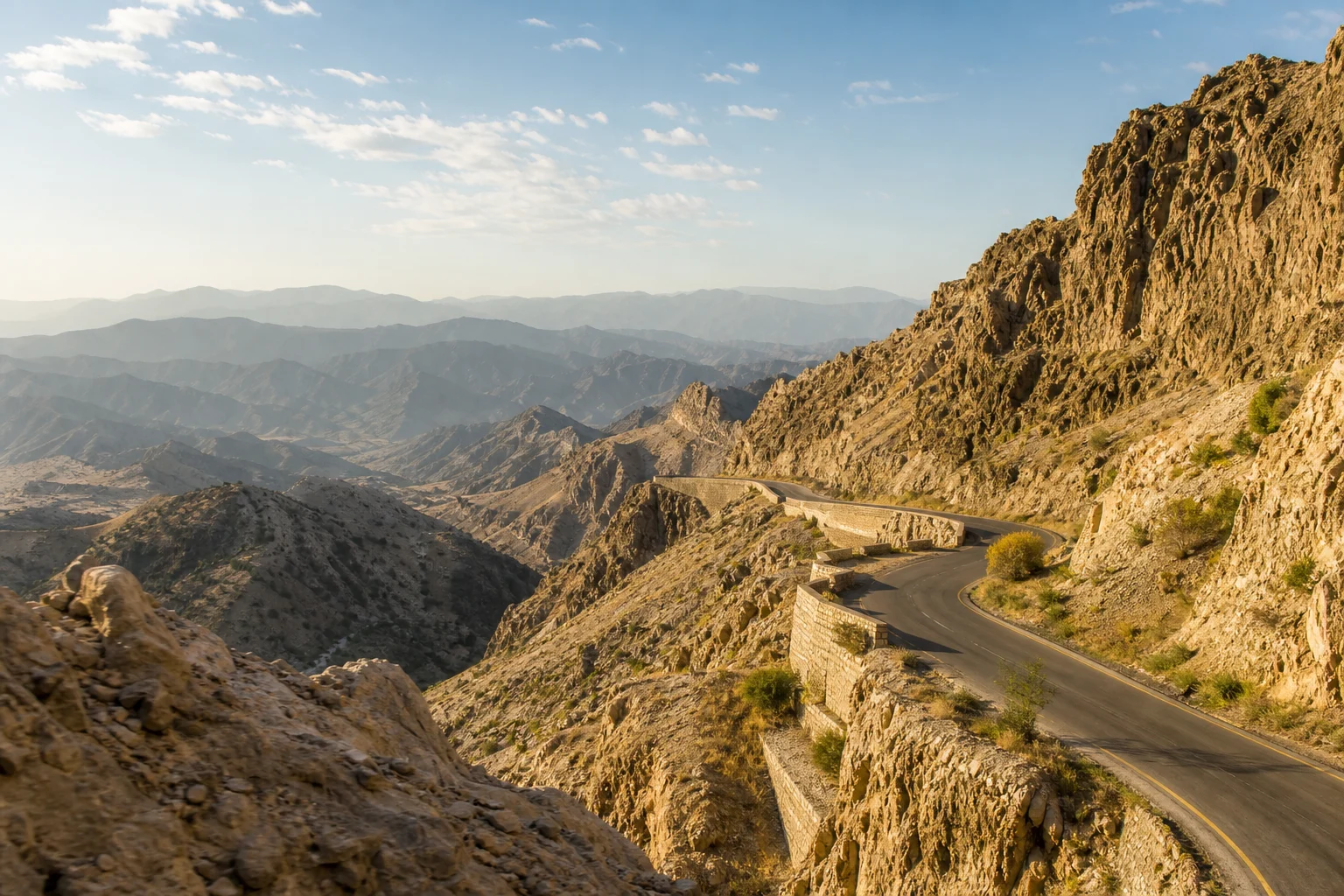
West of Peshawar, the land rises quickly. The cultivated expanse of the Peshawar Valley gives way to dry slopes, folded ridges and a road that narrows into stone. Here lies the Khyber Pass, one of Asia’s most resonant mountain corridors: a route running from the plain near Jamrud through the hills towards Landi Kotal and Torkham, at the frontier with Afghanistan.
Its name has become shorthand for a dramatic idea of history: armies pouring through a mountain gate. That image is not entirely wrong, but it is incomplete. The Khyber was never simply a funnel for conquerors. It was also a working landscape for the people who lived around it; a road for merchants, animal caravans, pilgrims and messengers; and a vital connection between Peshawar and the wider worlds of Kabul, Central Asia and the Indus basin.
To understand the pass is to look beyond the familiar roll call of emperors. Its deepest significance lies in the way geography made exchange possible—and in the communities that learned to live with, protect and negotiate one of the region’s most consequential routes.
A Passage Carved by Geography
The Khyber Pass cuts through the lower mountains associated with the Safed Koh range, linking the Peshawar Valley on the Pakistani side with the Kabul region beyond the frontier. At roughly 50 kilometres in length, depending on the route measured, it is not a single dramatic cleft but a sequence of ravines, climbs and narrow stretches. In some places the enclosing slopes feel severe and close; elsewhere the road opens briefly onto stony valleys before turning again between ridges.
This terrain explains both the pass’s importance and its difficulty. The mountains did not create an easy road. They created one of the more practical passages through a formidable barrier. Anyone moving between the highlands to the west and the fertile plains around Peshawar had to reckon with routes such as this one, their weather, water, gradients and local custodians.
At its eastern threshold stands Jamrud, close to Peshawar. Its fort, built in 1836 under the Sikh kingdom, remains a powerful marker of the pass’s strategic setting. Jamrud is not merely an outpost at the end of a road; it is where the mountains begin to press upon the plain. From there, the Khyber’s story unfolds westward through settlements and high points that once mattered to a caravan as much as a battlefield.
Peshawar and the World of Gandhara
The Khyber Pass cannot be separated from Peshawar. Long before the modern city took its present form, the Peshawar Valley stood at the heart of Gandhara, an ancient cultural region extending across areas of present-day north-western Pakistan and eastern Afghanistan. Its historic centres included Pushkalavati, near modern Charsadda, and Purushapura, the ancient city associated with Peshawar.
Gandhara flourished because it was connected. Rivers, valleys and overland roads linked it with Taxila to the south-east, Swat to the north, Kabul to the west and trade networks that reached far beyond. The Khyber was one important western approach in this wider geography. It helped make the Peshawar Valley a place where goods, artistic forms, religious thought and political power met.
Under the Kushans, especially between the first and third centuries, the region became a major centre of Buddhist learning and artistic production. Gandharan sculpture is celebrated for its distinctive visual language: Buddhist subjects rendered with a richness of drapery, architectural detail and stylistic influences shaped by long contact across Asia. These works are not evidence of a simple meeting of “East” and “West”; they are the result of artists and patrons working in a cosmopolitan region with its own deep traditions.
Trade helped sustain this world. Precious materials, textiles, spices and other goods moved through interconnected routes, while monks and travellers carried teachings between communities. The Khyber’s place in this story is therefore not only military. It belongs to the quieter infrastructure of civilisation: the road, the resting place, the marketplace, the guarded crossing and the city that receives arrivals.
Beyond the Legend of Endless Invasions
Few places have gathered more historical legend than the Khyber Pass. Popular accounts often state with certainty that every great conqueror of Central and South Asia marched through it. The truth is more careful. The pass and neighbouring routes were used over many centuries by rulers, armies and migrants, but the exact paths taken by particular ancient campaigns are not always securely documented. Mountain geography offers alternatives, and later retellings have often made the Khyber seem more singular than it was.
What can be said with confidence is that control of the approaches to Peshawar mattered repeatedly. The wider region came under the influence or rule of successive powers, including the Achaemenids, Mauryans, Indo-Greeks, Indo-Scythians, Indo-Parthians, Kushans, Shahis, Ghaznavids, Mughals, Durranis, Sikhs and the British. For each, the routes between the Kabul Valley and the Peshawar plain were economically and politically significant.
Yet a pass is not conquered once and for all. Its narrowness can favour those who know the ground; its openness can depend on agreements as much as garrisons. This was especially apparent in the history of the Afridi communities of the Khyber. Their knowledge of the terrain and their role in the life of the route meant that rulers and governments could not treat the pass as an empty strategic map. They had to negotiate with people whose homeland it was.
This point changes the story. Rather than imagining the Khyber as a stage upon which outsiders alone acted, it is more accurate to see it as a lived frontier. Local authority, customary relationships, trade interests and the difficult realities of mountain travel all shaped what could happen there.
Empire, Forts and a Hard Frontier
In the nineteenth century, the Khyber acquired a new prominence in imperial planning. As the Sikh kingdom and then British India sought to secure the approaches to Peshawar, the pass became a heavily watched frontier zone. Forts, roads, surveys and military posts expressed an ambition to make a difficult landscape legible and controllable.
But maps and masonry did not eliminate the pass’s complexity. The First and Second Anglo-Afghan Wars demonstrated the risks of projecting military force through this borderland. British control depended not only on troops and infrastructure but also on arrangements with local tribes and leaders. Such arrangements were often fragile, and the history of the period contains repeated conflict, loss and coercion alongside administrative ambition.
The British also reshaped the Khyber physically. The Khyber Railway, opened in 1925 between Jamrud and Landi Kotal, was an extraordinary engineering project. It climbed through steep country by means of bridges, culverts and tunnels, making visible the enormous labour required to force modern transport through a mountain route that had long resisted easy movement.
Today, the railway’s old alignment remains part of the pass’s historical imagination. More than a relic of engineering, it recalls an era when infrastructure was tied closely to imperial strategy. Its stations and tunnels belong to a layered landscape in which older caravan tracks, military roads and modern transport routes overlap.
A Pashtun Homeland, Not an Empty Border
The Khyber is inseparable from the cultural landscape of the Pashtun communities who have lived in and around it for generations. The social world of the pass has been shaped by Pashto language, hospitality, kinship, trade and strong traditions of local responsibility. To reduce this place to a “gateway” alone is to overlook the homes, bazaars, farms and settlements that give the route its human meaning.
Peshawar, meanwhile, has long absorbed and reflected this movement. Its food, languages, crafts and urban life carry traces of the valley’s position at a crossroads. In its old quarters, one can sense how a city becomes a threshold: neither isolated from the mountains nor wholly defined by them, but continually renewed by people arriving from connected regions.
This is also why heritage must be approached with care. The Khyber’s history includes archaeological landscapes, fortifications and transport infrastructure, but its most enduring heritage is not confined to monuments. It resides in cultural memory and in the everyday knowledge of terrain, season and travel passed through families and communities.
How to Read the Pass Today
For a visitor, the Khyber Pass should not be approached as a theatrical backdrop for tales of invasion. Its power lies in scale and context. The road between Peshawar and the frontier reveals how abruptly a great plain can meet the mountains, and how a route can shape the identity of an entire city.
Travel arrangements in the area can change according to local conditions and official requirements, so travellers should confirm current regulations before making plans, respect instructions at checkpoints and avoid treating communities as scenery. Photography may be restricted in sensitive locations. Modest dress, courteous conversation and an awareness that this is a home as well as a historic landscape are essential.
The most rewarding way to encounter the Khyber is to begin in Peshawar: to visit its museums and historic quarters, to learn about Gandhara, and to understand the city as the eastern companion of the pass. From that perspective, the mountains become more than a border. They become part of a long corridor of human connection.
The Khyber Pass has carried conflict, certainly. But it has also carried art, belief, commerce and ordinary life. Its cliffs do not tell one story of invasion; they hold a far longer record of encounter. In that record, Peshawar is not simply the city at the end of the road. It is one of the great places the road helped make.