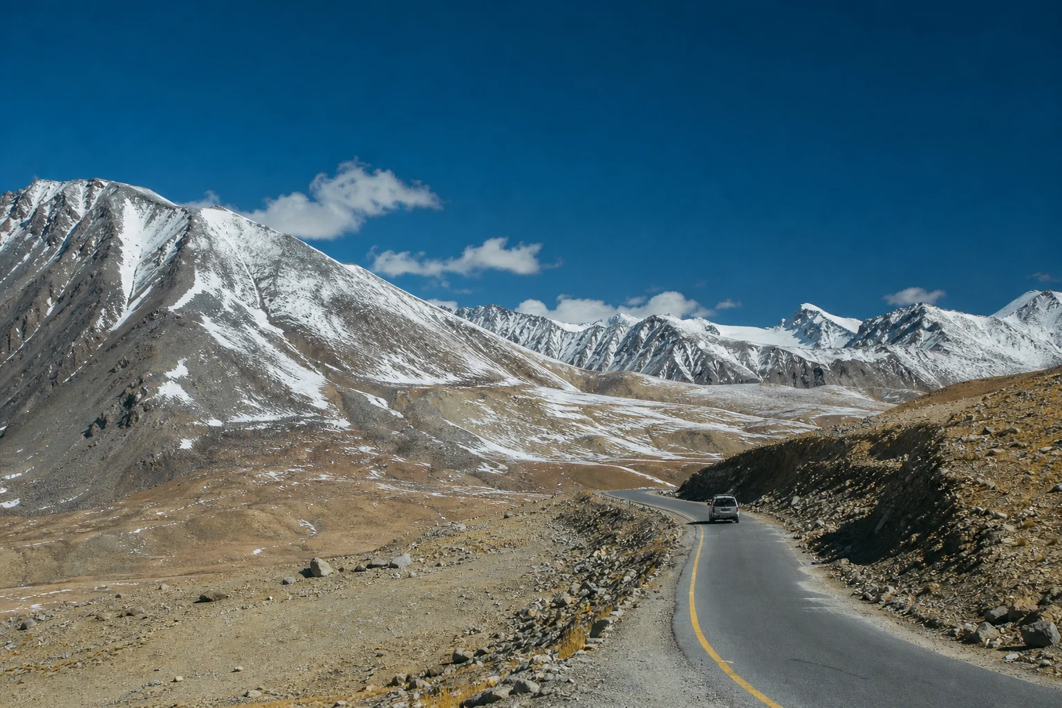
There is a moment on the road north from Hunza when the familiar drama of the Karakoram changes character. The Hunza River, orchards and clustered stone villages fall behind. The valley widens, the slopes become more spare, and the road begins to move through a world shaped by altitude rather than habitation. By the time it reaches Khunjerab Pass, the Karakoram Highway has climbed to 4,693 metres above sea level: a paved international crossing between Pakistan and China, and the highest point on the highway.
For many travellers, Khunjerab is a destination defined by a photograph at the border. Yet its deeper meaning lies in the journey towards it. The pass belongs to Upper Hunza’s high mountain geography, where settlement, trade, pastoral movement, road-building and wildlife conservation have long depended on the demands of a severe landscape. To travel here is to see how far Pakistan extends beyond its cities and plains—and how closely human life in the mountains is tied to weather, water and the patient work of keeping routes open.
A road through Upper Hunza
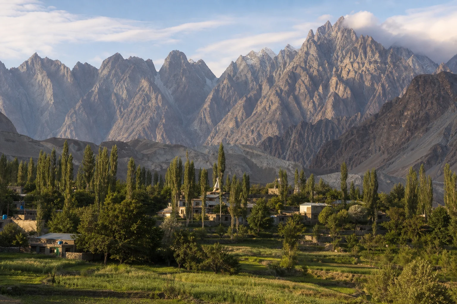
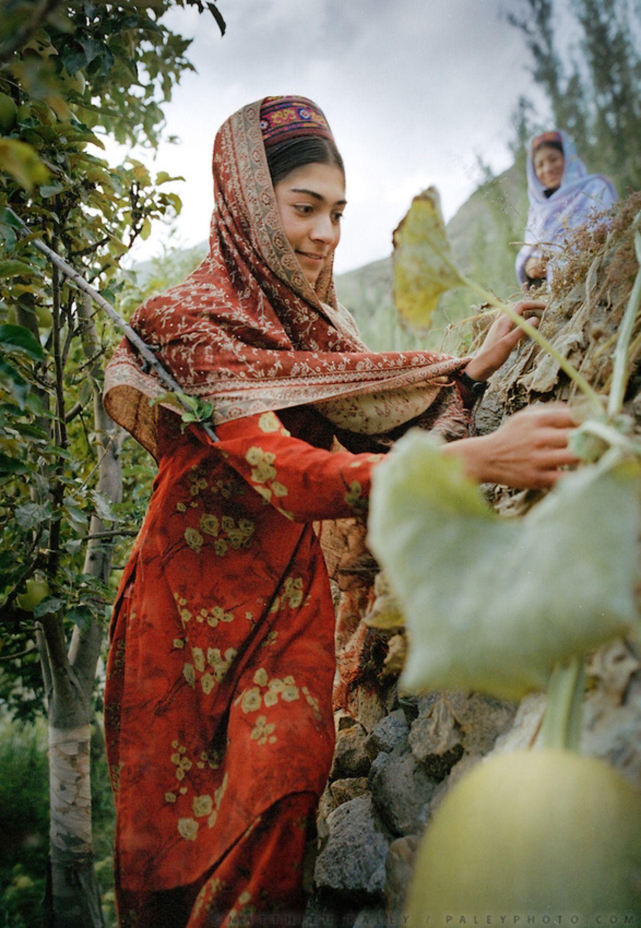
The approach begins in Hunza’s settled valleys and continues north through Gojal, the upper part of the wider Hunza region. Here, communities including Wakhi speakers have developed forms of mountain life around irrigated fields, fruit cultivation, livestock and close-knit village networks. The terrain is immense, but the inhabited places are intimate: apricot trees, poplars, channels carrying glacial water, mosques, schools and houses set beneath slopes that seem to rise almost vertically from the road.
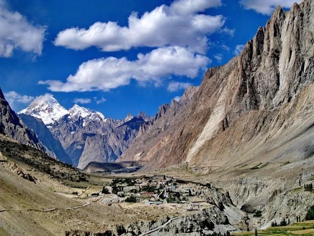
Beyond Passu and Gulmit, the journey passes through Sost, a significant service and customs town close to the border route. North of Sost, the human pattern thins out. The road enters the great open country associated with Khunjerab National Park, where the visual language of the valley changes from rock and cultivated green to high pastures, broad basins and snow-lined ridges.
This transition is one reason the route matters. Khunjerab cannot be understood as a single viewpoint at the end of a drive. It is the culmination of a gradual ascent through landscapes that reveal the layers of Hunza: agricultural villages sustained by glacier-fed water, roadside trade and travel, then a cold alpine plateau where permanent settlement is limited and the scale of the mountains takes over.
The highway and the human cost of connection
The Karakoram Highway is one of South and Central Asia’s most ambitious mountain roads. Constructed through a long period of Pakistani and Chinese cooperation and completed in the late 1970s, it created a modern road link across terrain that had historically been crossed by more difficult mountain routes. Its route through the pass superseded the older, unpaved crossings of Mintaka and Kilik as the main passage through this section of the Karakoram.
It is easy to admire the highway as an engineering achievement—and it is one. The road follows valleys cut by rivers, negotiates unstable slopes and enters country where snow, freeze-thaw cycles, landslides and rockfall can reshape conditions quickly. But its story should not be reduced to spectacle. The route was made by thousands of workers and engineers facing remote terrain and hazardous conditions. In the mountains, a road is never entirely finished; it requires continual surveying, maintenance and judgement.
For Upper Hunza, the highway has also altered the rhythm of distance. Villages that were once much more isolated became connected to wider markets, education, health services and visitors. That change has brought opportunity, while also placing pressure on fragile roadside environments and on communities adapting to a faster pace of movement. The most thoughtful way to experience the Karakoram Highway is not as a race to the highest signboard, but as a route through places whose lives existed long before the asphalt arrived.
At the top: a high-altitude plateau
Khunjerab Pass does not always look like the narrow, cliff-bound gateway travellers imagine. Near the summit, the landscape opens into a high, rolling plateau. In summer, alpine grass and low scrub soften parts of the ground; in colder months, snow and wind can make the terrain appear almost austere. The sky feels exceptionally close not because the mountains disappear, but because the road itself has risen into their weather.
At this elevation, the body notices what the eye may romanticise. The air contains less available oxygen, temperatures can shift sharply, and a brief walk can feel more strenuous than expected. Visitors should treat the pass as a high-altitude environment rather than an ordinary roadside stop. A gradual journey north, sensible hydration, warm layers, sun protection and light activity at the top are practical forms of respect for the landscape. Anyone with heart or lung conditions, or a history of altitude illness, should seek medical advice before undertaking such a trip.
Headache, nausea, dizziness, unusual fatigue or breathlessness should not be dismissed as part of the experience. Do not push higher or exert harder to complete a photograph. Tell companions, rest and descend when symptoms are concerning. The mountains are not impressed by bravado, and neither should the traveller be.
A protected landscape, not an outdoor backdrop
The pass lies within the wider Khunjerab National Park landscape, established in 1975 in part to protect the Marco Polo sheep. These wild sheep, known for the extraordinary sweep of the males’ horns, are among the region’s most recognisable animals, though seeing them is never guaranteed. The park also supports Himalayan ibex, blue sheep, Tibetan wolf, red fox, marmots, birds of prey and the elusive snow leopard.
Wildlife here should be approached with humility. The absence of an animal can be as meaningful as a sighting: it may simply be beyond the road, over a ridge or concealed in terrain where it belongs. Binoculars are better than pursuit. Drones, loud music, feeding animals and attempts to force a close encounter have no place in a protected high-mountain ecosystem. Even small disruptions matter in a habitat where food, shelter and breeding opportunities are constrained by long winters.
The park’s value is not confined to charismatic species. Its alpine pastures, scrublands, wetlands and seasonal watercourses form part of a larger mountain system shared by wildlife, herders and downstream communities. Glacial and snow-fed water that appears as ice and meltwater in the upper valleys eventually sustains fields and homes far below. A discarded bottle or plastic wrapper may seem trivial at a viewpoint; in a treeless, exposed landscape, it can remain visible for years.
Border, threshold and shared mountain world
Khunjerab is, of course, an international border crossing. That makes it different from a conventional scenic pass, and travellers should be prepared for the formalities, documentation requirements and access restrictions that border regions require. Conditions can change with weather, road maintenance, official regulations and wider travel arrangements. Check current requirements with relevant authorities and reputable local operators before setting out, rather than relying on old social-media posts or stories from previous seasons.
Yet the pass is also a reminder that mountain landscapes exceed administrative lines. The ridges and plateaus continue into Xinjiang, while the cultural and ecological world of Upper Hunza has long been shaped by connections across high valleys. Trade, movement and exchange have historically followed routes that rarely resemble the clean lines on a modern map. The Karakoram Highway brought a new kind of connection, but the older truth remains: people in the mountains have always understood passes as thresholds between worlds.
That is why the place calls for care in language as well as behaviour. It is tempting to describe Khunjerab only through superlatives—the highest, the grandest, the most remote. Those phrases capture scale but miss texture. The pass is also part of the everyday geography of people living along the highway: drivers watching forecasts, shopkeepers in Sost, families tending orchards in Gojal, conservation staff monitoring wildlife and road crews responding to a landscape that never becomes fully predictable.
How to experience Khunjerab with care
A rewarding visit begins with time in Hunza rather than a hurried dash from lower elevations. Spend at least a few days in the region, learn the changing character of the valleys, and let the journey north unfold in stages. The pass becomes more legible when seen in relation to the villages, glaciers and mountain walls below it.
- Travel slowly: Build flexibility into the itinerary. Mountain roads can be affected by weather, rockfall and maintenance, and the safest plan is one that allows for delay.
- Prepare for exposure: Carry insulating layers, a windproof outer layer, sunglasses, sunscreen, water and snacks. Even in bright sunshine, the pass can feel cold and windswept.
- Respect local rhythms: Ask before photographing people, homes, workplaces or religious spaces. Support local businesses along the route and listen when hosts or drivers advise caution.
- Leave the landscape intact: Use bins where available, carry out what you bring in, stay on permitted areas and do not remove plants, stones or other natural material as souvenirs.
- Keep the border practical: Carry required identification and permits, follow instructions from officials, and verify current crossing or visitor arrangements well before travel.
The meaning of the high road
Khunjerab Pass is often presented as the grand finale of a road trip through Hunza. In one sense, it is: few journeys rise so visibly from cultivated valleys to such an elevated frontier. But the pass is more compelling when viewed as a conclusion that sends the traveller back through the landscape with new attention.
On the return south, the green of Gojal appears richer, the settlements more improbable and the river valleys more clearly precious. You begin to understand that Hunza’s beauty is not simply a matter of peaks. It is the result of human adaptation in places where water must be guided, slopes must be read and distance has always had a cost.
At Khunjerab, the Karakoram Highway touches the sky. The lasting impression, however, is not of conquest over the mountains. It is of coexistence with them: imperfect, demanding and deeply human.